
The early weeks of the 2026 Atlantic hurricane season have provided the results one might expect in a season predicted to be dominated by El Niño and forecast to produce a below-average number of systems.
Read more 3 arrested after $360K stolen in Miami-Dade home invasion while teen inside, MDSO says
While that doesn’t mean that no storms form, the infrequency of areas to monitor is a refreshing change.
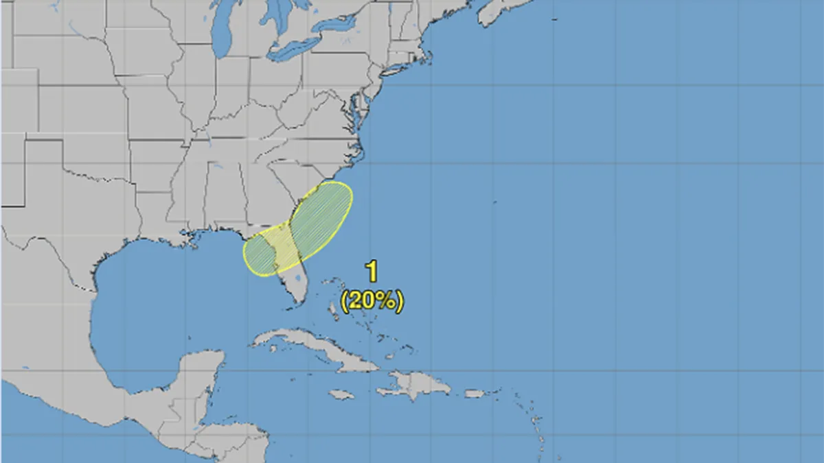
This week there is a new area to watch that encompasses the northeastern Gulf of Mexico and the southwestern Atlantic waters adjacent to Florida, Georgia and the Carolinas.
In the short term, the National Hurricane Center in Miami is not concerned about development chances. Their current outlook for the next 5 days holds development chances at zero percent.
However, in the longer range, there is a small chance for development with probabilities of around 20%. By their standards this is a “low” chance classification, but here’s why it matters.
Although chances are slim for tropical development, the set-up for something to percolate may be somewhat suitable as low pressure may develop along a fading frontal boundary. This is a common mode for “near shore” development adjacent to the United States.
Read more Woman arrested after stabbing at Hialeah Tri-Rail station leaves man critical, MDSO says
Whether or not development occurs, a welcome rain event could unfold for central and northern Florida, which remains entrenched in drought.
It is too soon to know if this will simply be an area to monitor for a few days, or, if development will occur.
Per climatology, the second named system of the season usually comes mid-to-late July.
The season’s next name is “Bertha.” If it develops, this will follow June’s short-lived “Arthur” that brought heavy rainfall to Texas and Louisiana as a brief, low-end tropical storm.
Read more Man dies after body ‘severed’ in Florida Keys work incident, sheriff says