
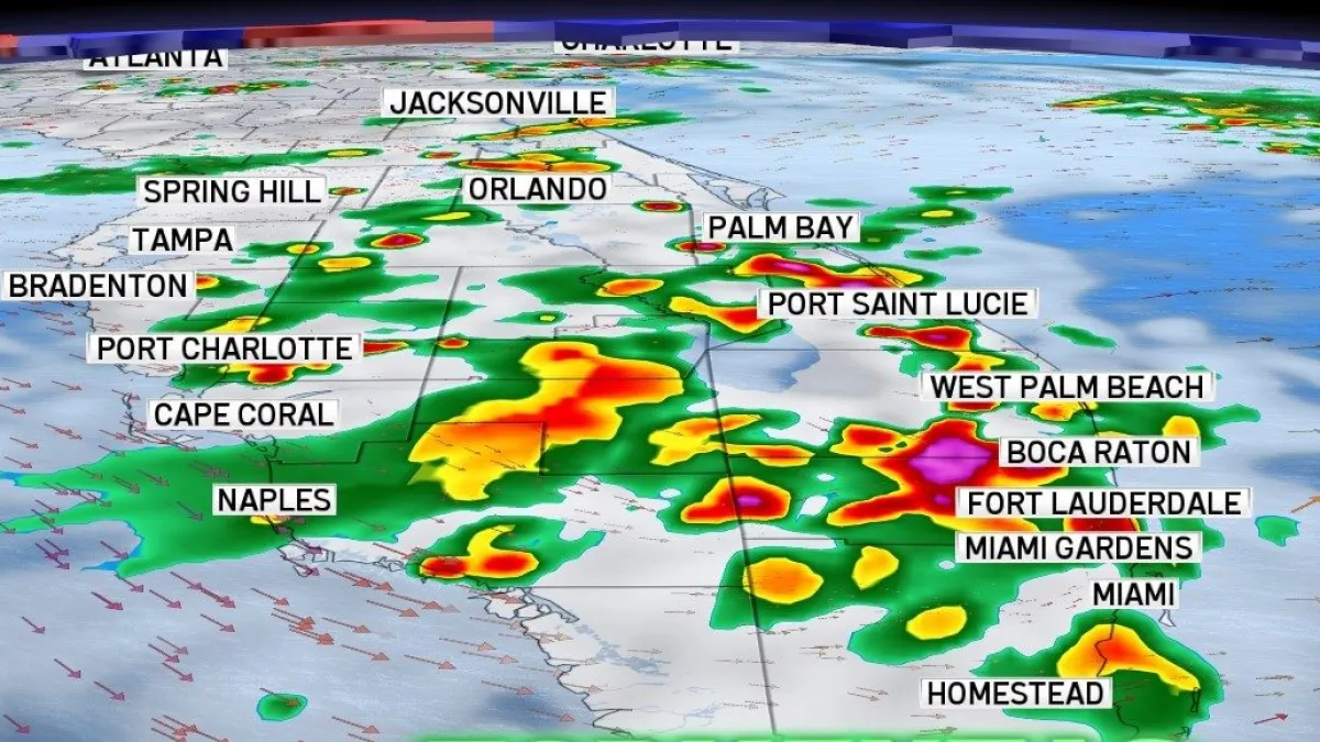
After several days dominated by heat and only very isolated showers, South Florida is getting ready for a major shift in the weather pattern that will bring a significant increase in the coverage of downpours and thunderstorms starting this Saturday and, especially, from Sunday into early next week.
Read more 49ers coach Kyle Shanahan suffers non-life-threatening injuries in car accident
While the rainfall will be welcome news to partially ease the drought affecting the region, it will also raise the risk of urban flooding due to the possibility of repeated rain over the same areas.
What’s causing this change?
For much of the week, an area of high pressure over the Atlantic and the presence of relatively dry air limited storm development, focusing most activity over inland and Southwest Florida.
However, that pattern will begin to shift over the weekend. An upper-level trough will strengthen over the eastern United States, while a series of frontal systems will remain stalled north of Florida. At the same time, a deep stream of tropical moisture will set up over the southern part of the state.
The combination of these factors will make the atmosphere much more favorable for thunderstorms to develop each afternoon.
The biggest change will be wind direction
One of the most important aspects of this new pattern will be the gradual shift in low-level winds.
Over the past few days, easterly winds pushed most storms inland and toward the Gulf Coast. But starting Sunday, the flow will change and begin to blow with a stronger westerly component.
That shift will steer storms toward the East Coast metro area, significantly increasing rain chances for cities such as Miami, Fort Lauderdale, Hollywood, Pembroke Pines, Hialeah, Kendall, and West Palm Beach—especially during the afternoons and early evening hours.
What can we expect each day?
Saturday
It will feel more humid, and more numerous storms will begin to develop during the afternoon. While inland areas will still see the most activity, several storms may move toward the East Coast.
Read more Kaepernick, Springsteen receive new ACLU award for activism in arts, business, science and sports
Sunday
The pattern will become much more active. Frequent downpours and thunderstorms are expected across much of South Florida, including the metro area. Some rain could be heavy and long-lasting.
Monday and Tuesday
This appears to be the wettest period in the forecast. The combination of abundant tropical moisture and westerly winds will favor the development of numerous storms through much of the afternoon and night, especially along the East Coast.
Risk of localized flooding
While a widespread flooding event is not expected, repeated storms over the same areas could lead to significant rainfall totals in a short amount of time.
The main concerns will be:
- Temporarily flooded streets.
- Standing water in areas with poor drainage.
- Reduced visibility during the heaviest downpours.
- Travel delays during the afternoon rush.
The strongest storms could also produce gusty winds, frequent lightning, and torrential rain.
The heat will continue
Despite the increase in rain, the heat won’t go away. High temperatures will continue to reach the low 90s°F each afternoon and, during dry stretches, the heat index could again top 100°F, even approaching 105°F in some spots.
When will the weather improve?
Forecasts indicate the wetter pattern could stick around at least through the middle of next week. After that, rain chances would gradually start to decrease, although the typical South Florida summer pattern will continue to favor afternoon showers and thunderstorms.
This story was translated from Spanish with the help of a generative artificial intelligence tool. An NBC6 digital editor reviewed the translation.
Read more Simone Biles undergoes medical treatment after ‘almost dying’ in June