
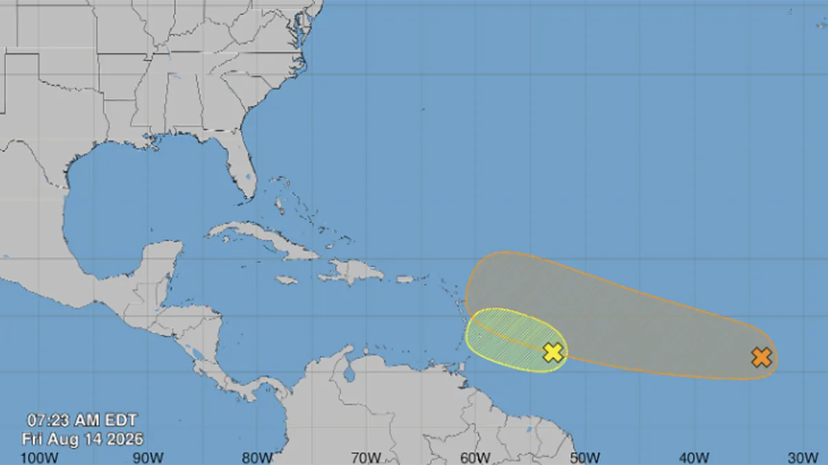
Forecasters continue to watch two tropical waves as they meander in the open waters of the Eastern Atlantic on Friday.
Read more Miami Hurricanes RB Jordan Lyle arrested on fleeing and eluding charges, records show
The first wave chances of development have been lowered, as expected, and the second wave behind it still has a medium chance of development, according to the National Hurricane Center in Miami.
There is so much Saharan dust that is north of both storm clusters so it has kept them from moving north. The dust is steering these storms east to west.
As the first wave crosses the Lesser Antilles by Saturday, it’ll bring much needed rain to the drought ongoing on the islands mainly in the Windward Island region. It’ll move into the Caribbean sea by Sunday but there is strong wind shear that looks to shred any development by early next week.
Models were picking up on this a few days ago and its looking more and more likely for limited development.
Read more Boxer Prichard Colón dies 11 years after suffering brain injury during match
The second wave may try and find a gap in the Saharan dust after the weekend and start to take a slightly more northerly track into early next week. That will be it’s limited window to strengthen if it does.
More rain for the Leeward Islands is expected with the secondary wave by the middle of next week. Again, there is still a bit of wind shear that will give the wave a harder time to strengthen but we’ll see what the trends look like as it approaches the Lesser Antilles by midweek.
Tropical Storm Cristobal was short-lived and dissipated on Thursday after forming on Wednesday west of the Azores.
Read more Multiple people arrested in disabled parking permit fraud crackdown in Miami-Dade